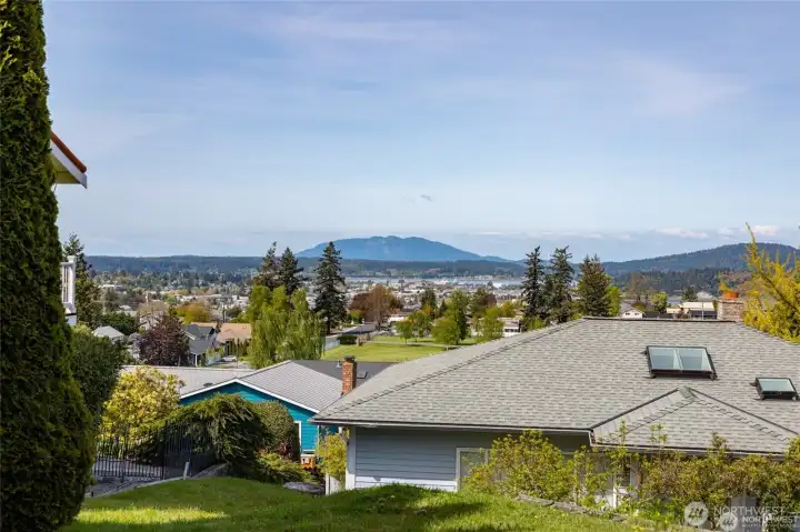
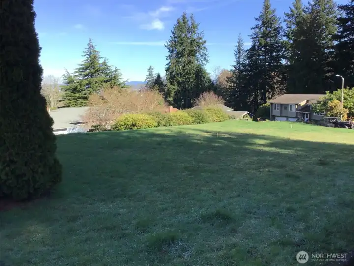
This view would be very similar to views from a second story home build on your new lot.
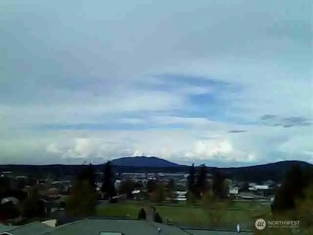
 This is the April sky in the evening from about 20 feet in the air directly above the lot.")
Natural photos (no filters or enhancements on any) This is the April sky in the evening from about 20 feet in the air directly above the lot.
")
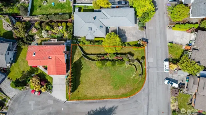
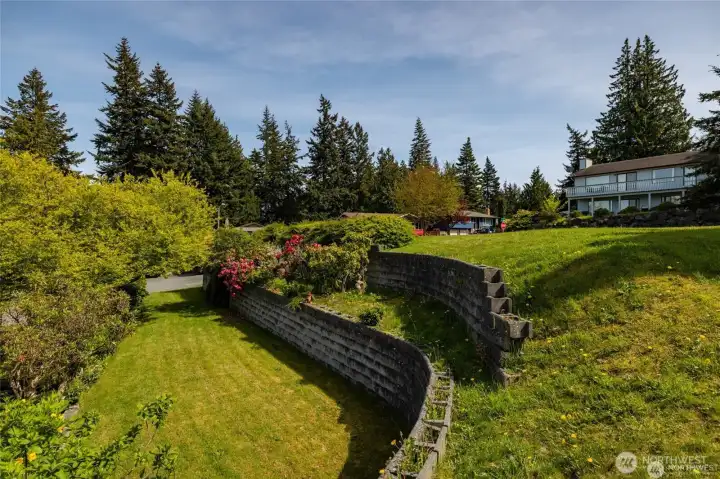
The top of this sketch is facing is west not north. Please note that the northerly edge of the retaining wall is many feet from the property line. While onsite at the street on the east side, look for the mailboxes and you'll see two water meters. This is the property line. (between water meters)
")
The top of this sketch is facing is west not north. Please note that the northerly edge of the retaining wall is many feet from the property line. While onsite at the street on the east side, look for the mailboxes and you'll see two water meters. This is the property line. (between water meters)

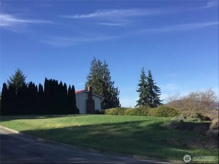
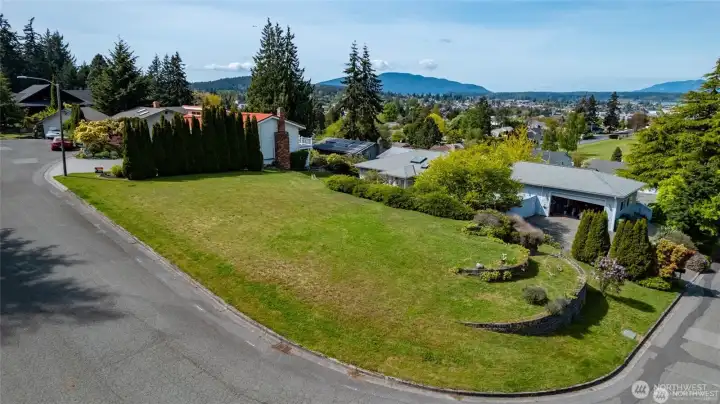
Looking to the North East from a drone photo taken from about 20 feet up near the middle of the lot. On a clear day, Mt Baker could be seen here.... check back for photo updates soon for a better view picture.

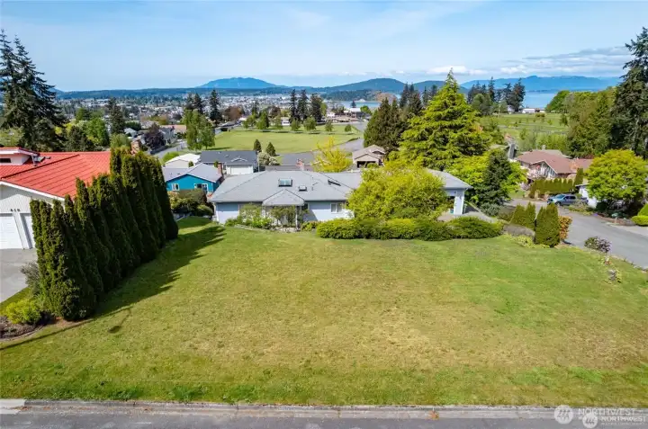
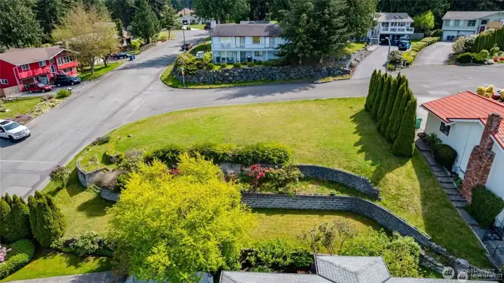
This view would be similar to what you'd see from a second story home you build on this lot. It is looking Southwest into the culdesac.

Little Cranberry Lake within the Anacortes Communty Forest Lands.

One of the San Juan Islands accessible from the nearby Washington State Ferries on the west end of Anacortes.

Taken from a boat in the San Juan Islands that are accessible from a public boat launch at Washington Park, Cornet Bay, Skyline Marina, or Cap Sante Marina. Or, take a ferry ride.

Little Cranberry Lake within the Anacortes Communty Forest Lands.

Taken from Memorial Park in DT Anacortes

Moor your boat at Cap Sante Marina and adventure out to the San Juan Islands.

One of the San Juan Islands accessible from the nearby Washington State Ferries on the west end of Anacortes.

Taken from a boat in the San Juan Islands that are accessible from a public boat launch at Washington Park, Cornet Bay, Skyline Marina, or Cap Sante Marina. Or, take a ferry ride.

Taken from the Skagit Valley of Anacortes and the San Juan’s.

The upper Skagit River about 45 minutes drive east.

Upper Skagit River again