Aerial view - gentle slope, private, and lightly treed.

A filtered view of the 17th fairway. This is a quiet, dead-end drive in the Alderbrook community.

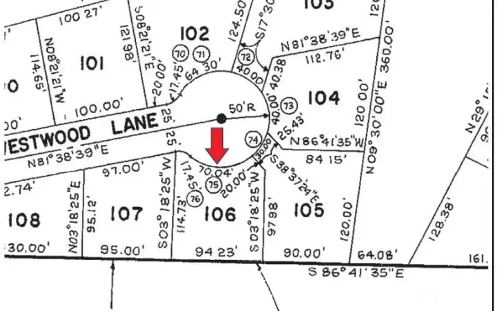
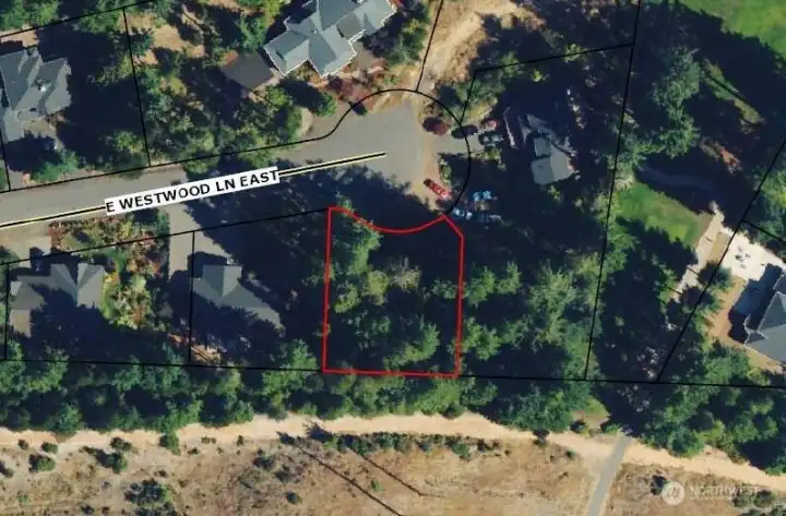
Aerial view of 10,019 sq. ft. lot. Property lines are approximate.

Soil evaluation records from 2012 are available from Mason County.

Quiet cul de sac has new or newer homes.

Gently sloped!

Aerial view and property lines are approximate.

View of Hood Canal and the Olympic Mountains from the clubhouse viewpoint.

Clubhouse with restaurant!

The 18th fairway.

Aerial view of the clubhouse, 18th fairway, and viewpoint.

Community park has picnic areas, tennis courts, a pickle ball court, bocce ball courts, horseshoe pits, a basketball court, playground, and community gardens.

Aerial view of community park.

Tennis courts.

Aerial photo showing proximity to Hood Canal recreation.

Aerial photo showing proximity to Hood Canal recreation.