40 Acres south of Ephrata.

Photo is from the southern side of Road 10.8. Property is to the northwest of the squared-off, green area on the right middle of the photo. No access from Road 10.8.

Photo is looking from southeast corner, which is above the green triangle, toward the northwest.

Photo is from the east looking west. The southeast corner is near the squared-off green area on the left. You can draw a straight line through the middle of the photo, northward. Road 10.8 is on the left edge of the photo with no access.

Photo is from the northeast corner, looking westward towards the southwest corner. No access from Road 10.8.

Photo from the north looking south towards Road 10.8, which there is no access.

Photo is from the northwest corner of the property, looking towards the southeast corner.

Photo is from the western boundary looking eastward. Access is from Road A, on Road 11, towards the corner of the green area.

Photo is from the southwest boundary looking northeast. Access is from Road 11 at the corner of the green area, towards Road A.

Photo is from ground level, looking towards the northeast.

Ground photo is from the north looking south.

Ground photo is from the east looking west at 3:00 pm.

Ground photo looking from the southeast corner to the west.

Photo is from the southeast corner looking to the northwest.

Photo is from the southeast corner, looking north.

40 Acres from the Grant County map.

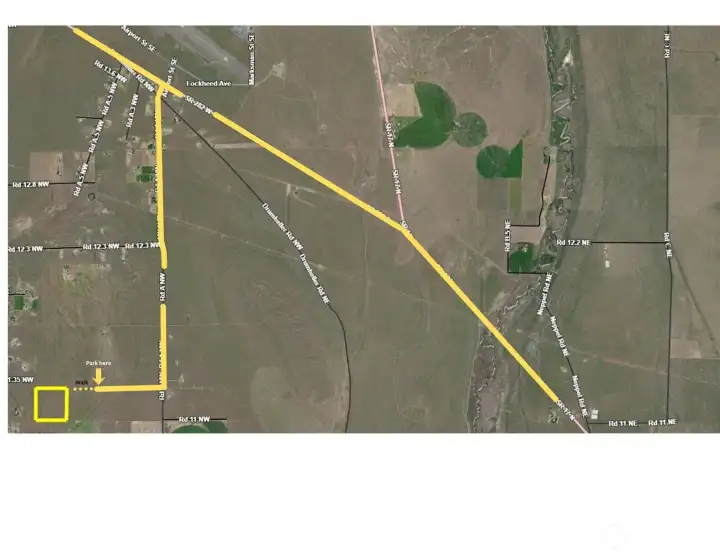
Access is from Road 11 via Road A, south of Ephrata.

South of Ephrata.